
The Conwy Valley looking south — Wikimedia Commons, CC BY-SA 2.0
The Conwy Valley looking south — Wikimedia Commons, CC BY-SA 2.0
Conwy County Borough was created in 1996 when local government reorganisation merged the former districts of Aberconwy and Colwyn into a single unitary authority. It covers roughly 1,130 square kilometres and is home to around 116,000 people — one of the larger and more sparsely populated counties in Wales outside the industrial south. The administrative centre is Conwy town itself, though Llandudno and Colwyn Bay are considerably larger in terms of population, and the majority of residents live within a few kilometres of the Irish Sea coast.
The county spans a remarkable range of landscapes for its size. The northern edge is a 30-kilometre arc of Irish Sea coast running from the Great Orme headland west of Llandudno to the low-lying shores near Abergele in the east. Behind the coast, the ground rises through farmland and conifer forestry to the high moorland of Mynydd Hiraethog in the east — a broad, treeless plateau used for sheep grazing and largely trackless even today. To the west and south, the landscape is dominated by the mountains of Snowdonia: the Carneddau range, whose highest peaks exceed 1,000 metres, forms the county’s western boundary and its most dramatic skyline, while the valleys that drain these mountains cut deep into the interior, creating the sheltered terrain that allowed human settlement to take root here long before the coastal plain was developed.
The River Conwy is the defining geographical feature. Rising high on the Migneint plateau and flowing north for over 45 kilometres to the sea, it has shaped the landscape, economy and history of the area for millennia. The valley it carves — broad and fertile in its lower reaches around Llanrwst, steep and wooded further south around Betws-y-Coed and Dolwyddelan — was for centuries one of the main routes from the coast into the heart of Snowdonia. It remains so today: the A470 road and the Conwy Valley Railway both follow the river south from Llandudno Junction, making the valley unusually accessible for a landscape of this grandeur. The estuary at the northern end, where the freshwater river meets the tidal Irish Sea, is one of the most biodiverse stretches of inshore water in North Wales, its mudflats and saltmarshes supporting internationally significant numbers of wading birds and the county’s celebrated mussel fishery.
Culturally, the county has a dual identity that shapes everything from language to politics. The coastal strip — Llandudno, Colwyn Bay, Abergele and the resort towns — was heavily anglicised during the Victorian expansion and retains a character closer to English seaside towns than to any Welsh archetype. The interior is a different matter entirely: Llanrwst, Betws-y-Coed and the farming communities of the valley and uplands are strongly Welsh-speaking, with the language heard in shops, pubs and schoolyards as a natural everyday medium rather than a cultural gesture. This tension between the anglicised coast and the Welsh-speaking interior gives Conwy County a cultural richness and complexity rarely found in more homogeneous parts of Wales.
For the visitor, the county’s diversity is its greatest asset. You can walk into Snowdonia from the coast in a single day, travel the entire length of the Conwy Valley by train without a car, eat mussels pulled from the estuary that morning, or explore a medieval walled town that has changed less than almost anywhere in Britain. The county does not lend itself to a single narrative or a single type of visit: it rewards the curious, the unhurried, and those willing to leave the main roads to find what lies at the end of them.

One of the best-preserved Victorian seaside resorts in Britain — the sweeping North Shore promenade, the pier and the Great Orme headland.
Llandudno guide →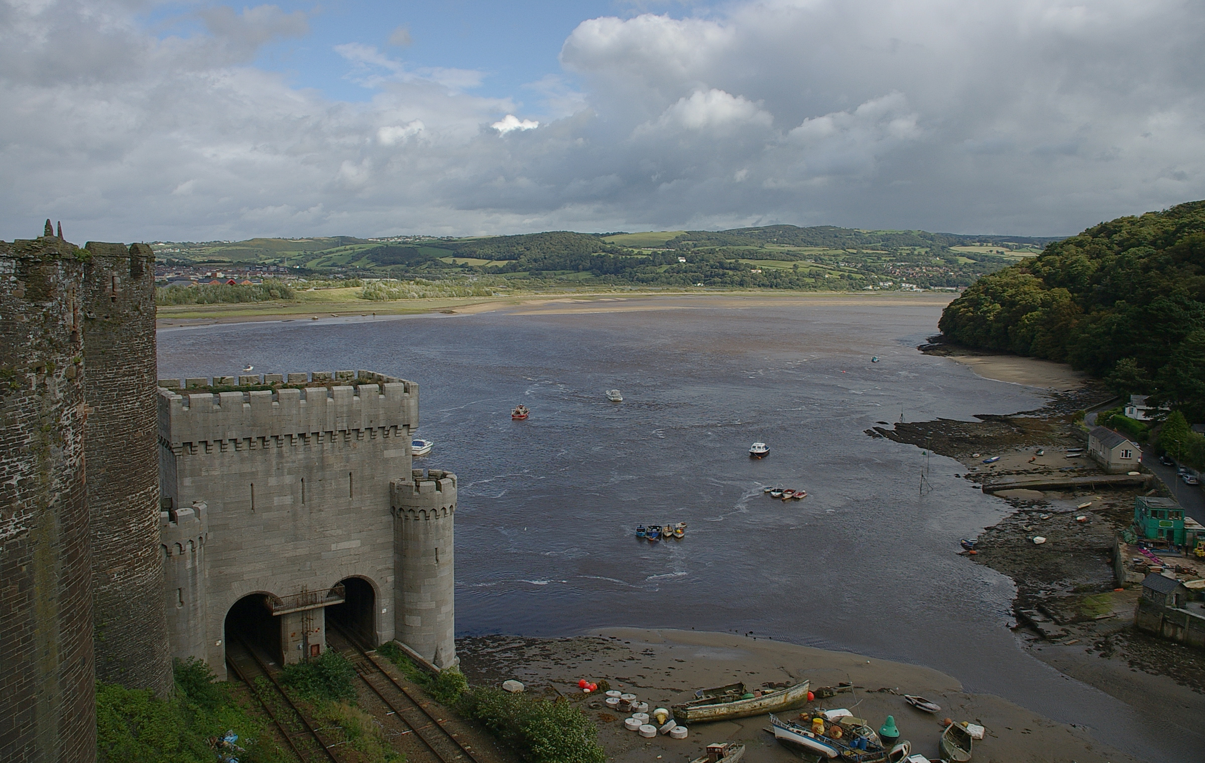
The medieval walled town at the heart of the county — its castle, harbour and near-complete circuit of walls form a UNESCO World Heritage Site.
Conwy guide →
The gateway to Snowdonia at the confluence of four rivers — waterfalls, forest walks and mountain access in one of Wales’s most visited villages.
Betws-y-Coed guide →
45 kilometres of river from the Migneint plateau to the tidal estuary, taking in Llanrwst, ancient oak woodland and the richest farmland in North Wales.
Valley walk guide →
The market town of the Conwy Valley — Pont Fawr bridge, Gwydir Castle, Tu Hwnt i’r Bont tearoom and a strong Welsh-speaking identity.
Llanrwst guide →
A coastal village squeezed between the Carneddau and the sea — Neolithic axe factory site, beach and direct Carneddau walking access.
Penmaenmawr guide →
Llandudno Bay — Wikimedia Commons, CC BY-SA 2.0
Llandudno is the county’s largest settlement and one of the best-preserved Victorian seaside resorts in Britain. Built on the limestone peninsula between the Great Orme and Little Orme headlands, it was planned from scratch in the 1850s on land owned by the Mostyn Estate and retains its original grid plan and seafront character almost intact. The sweeping North Shore promenade, the 650-metre pier — the longest in Wales — the elegant terrace hotels and the Victorian cable tramway to the Great Orme summit are all still in place. The tram climbs at gradients of up to 1-in-4 and is one of only three remaining cable tramways in Britain, making it a genuine piece of living Victorian engineering rather than a heritage reconstruction. The town has a strong literary association: the Liddell family holidayed here in the 1860s and Lewis Carroll is believed to have corresponded with Alice Liddell — the inspiration for Alice in Wonderland — while staying in the town. The Oriel Mostyn Gallery on Vaughan Street is a free contemporary art gallery widely regarded as one of the best in Wales, occupying a magnificent Victorian building that has been sensitively restored. Llandudno has two beaches: the broad, sheltered North Shore facing the bay and the quieter West Shore on the Conwy estuary side, each with a different character and atmosphere.
The Great Orme headland, rising 207 metres above the sea at the western tip of the bay, is one of the most distinctive landmarks in North Wales and a Country Park of outstanding natural interest. Its summit is accessible by Victorian cable tramway, by cable car or on foot via several well-marked paths, and on clear days the views extend across the Irish Sea to the Wicklow Mountains of Ireland, the Isle of Man and the Lake District fells. The Bronze Age copper mines beneath the headland are the largest discovered prehistoric mine in the world, worked for over 1,500 years before their eventual abandonment around 600 BC; visitors can explore the tunnels on guided tours and see the antler and bone tools used by the miners. The limestone grassland of the headland supports rare wildflowers including bloody cranesbill, hoary rockrose and spring cinquefoil, and the cliffs are home to nesting seabirds. The headland’s most celebrated residents are the semi-feral herd of Kashmir goats — over 100 animals — descended from a pair gifted by the Shah of Persia to Queen Victoria in 1837; they have roamed the Orme freely ever since and are occasionally seen venturing into the streets of Llandudno itself during particularly harsh winters.
Colwyn Bay, six kilometres east of Conwy, is the county’s second largest settlement. It grew as a residential and holiday town in the late Victorian period, spreading along the coast through the suburb of Rhos-on-Sea toward Old Colwyn, and has a more workaday character than Llandudno. The Welsh Mountain Zoo, situated on a hillside above the town with panoramic views over the bay, is the only zoo in Wales and home to animals ranging from snow leopards to Sumatran orang-utans; its elevated woodland setting makes it one of the most attractively sited zoos in Britain. The Victorian pier at Colwyn Bay was closed and partly demolished in the 1990s but has been subject to restoration plans for many years; the seafront retains its Victorian structure even if some of the original grandeur has faded. At Rhos-on-Sea stands the tiny 6th-century chapel of St Trillo, built over a freshwater spring literally on the seafront; measuring just 11 feet by 7 feet and capable of holding perhaps six people, it is one of the smallest churches in Britain and a remarkable survivor yards from the water’s edge. Abergele and the nearby coastal resort of Pensarn mark the eastern boundary of the county and the transition from the Conwy basin to the Vale of Clwyd; the town is on the Chester–Holyhead railway and serves as a market town for the agricultural hinterland of the eastern moors.
At the western end of the county, the coast between Conwy and Penmaenmawr is one of the most dramatic sections of the entire North Wales shore. Here the Carneddau mountains descend with almost geological abruptness to the sea, leaving barely room for the railway and the A55 expressway to thread through between cliff and water. This section of coast was one of the great engineering challenges of the railway age: Robert Stephenson’s solution was to bore a tunnel through the headland at Penmaen-bach, completed in 1848, while the later construction of the A55 required a new coastal tunnel beneath the same headland. Penmaenmawr itself is a small coastal village with a sandy beach and direct walking access onto the Carneddau, but its most remarkable feature lies hidden on the hillside above: the Graig Lwyd quarry was one of the most important Neolithic stone axe factories in Britain, producing polished stone axes found as far afield as Yorkshire and Lincolnshire, evidence of a trading network of extraordinary reach for a pre-metal-age society. Llanfairfechan, the next village along the coast to the west, sits where the Llanfair valley meets the sea and offers a quieter beach and excellent footpath access into the western Carneddau.
The Wales Coast Path runs through the county for its entire coastal length, linking all the coastal settlements from Abergele in the east to Llanfairfechan in the west. The section between Conwy and Llanfairfechan is particularly spectacular, following the shoreline past the estuary, across Conwy Morfa beach and then climbing through the dramatic pass at Sychnant before descending to the coast near Penmaenmawr. The complete coastal section through Conwy County can be walked in two to three days, making it an excellent multi-day route that combines beach, headland and mountain walking within a compact area. The coast itself changes character markedly from east to west: the sheltered sands of Llandudno and Rhos-on-Sea give way to the more exposed and wilder shore of Penmaenmawr and Llanfairfechan, where the sea is more Atlantic in character and the views back along the coast to the Great Orme are magnificent on a clear day.
The Conwy Estuary is a landscape in its own right. The tidal reach of the river extends over six kilometres inland from the sea, creating an extensive area of mudflats, saltmarsh and open water that is central to the county’s wildlife heritage. The estuary is designated a Site of Special Scientific Interest for its invertebrate-rich mudflats and the nationally significant numbers of wading birds they support. Conwy mussels have been harvested from the estuary since at least the medieval period, and the beds on the tidal flats below the castle walls remain in commercial production today, supplying restaurants across North Wales and beyond. Thomas Telford’s 1826 suspension road bridge and Robert Stephenson’s 1848 tubular railway bridge both cross the estuary at Conwy, the two structures sitting alongside each other as a remarkable monument to successive ages of transport engineering. A third road crossing — the Conwy Tunnel — was completed in 1991, finally bypassing the old bottleneck at the town and allowing through traffic to pass beneath the estuary floor without disturbing the medieval townscape above.
Search hotels, B&Bs, guesthouses and self-catering in Conwy and the surrounding area — powered by Booking.com.
Search Accommodation on Booking.com →Powered by Booking.com — our affiliate partner
Afon Conwy and the estuary — Wikimedia Commons, CC BY-SA 3.0
The River Conwy and its valley are the geographical spine of the county. The river rises in Llyn Conwy, a high moorland lake on the Migneint plateau, and flows north for over 45 kilometres before widening into the tidal estuary at Conwy town. The valley varies enormously along its length: steep, wooded and narrow in its upper reaches around Betws-y-Coed and Dolwyddelan, it opens into a broad, fertile flood plain around Llanrwst before narrowing again between the Carneddau foothills, then widens finally into the tidal estuary. This variety of character within a single valley is unusual even by Welsh standards, and it means that a journey along the full length of the valley — whether by road, rail or on foot — passes through genuinely distinct landscapes rather than a uniform scene.
Llanrwst, 12 miles south of the coast, is the main market town for the inland parts of the county and one of the most thoroughly Welsh-speaking settlements in the northern half of the country. Pont Fawr, the three-arched stone bridge built in 1636 and attributed by tradition (though disputed by historians) to Inigo Jones, is the oldest multi-span bridge in Wales and one of the most photographed structures in the valley. On the far bank stands Tu Hwnt i’r Bont, a 15th-century courthouse now run as a tearoom by the National Trust, particularly celebrated in October when its Virginia creeper turns a vivid and photogenic scarlet. The town’s Thursday market has served the farming communities of the valley for centuries and remains a genuine working market rather than a tourist attraction, with farmers from the surrounding hills bringing stock and produce to town. Gwydir Castle, a mile south of Llanrwst, is an Elizabethan manor house of extraordinary historical interest: its 1621 Dining Room panelling was sold in the 1920s to the American press baron William Randolph Hearst, eventually made its way to the Metropolitan Museum of Art in New York, and was only returned to the castle in 1996 after a remarkable international negotiation.
Trefriw, a few miles north of Llanrwst on the west bank of the river, has been a place of minor pilgrimage and industry for centuries. The Trefriw Woollen Mills has been weaving Welsh tapestry cloth on the same riverside site since the mid-19th century — originally driven by a waterwheel on the Afon Crafnant — and visitors can watch the power looms at work and buy fabric direct from the mill, one of only a handful of working weaving mills still operating in Wales. Above the village, Llyn Crafnant is one of the most beautiful mountain lakes in the county and can be reached on foot from the village in under an hour, offering a half-day walk that starts at sea level on the valley floor and ends in the open hills above the treeline. In the Victorian period, Trefriw’s chalybeate spring — iron-rich water believed to have medicinal properties — drew visitors by steamboat from Conwy and Llandudno, creating a small spa economy alongside the valley’s agricultural life; the spa buildings survive in part and the spring remains accessible to visitors today.
South of Llanrwst the valley narrows and steepens toward Betws-y-Coed, the most visited village in Snowdonia and the gateway to the high mountains. It sits at the confluence of the Conwy, Llugwy and Lledr rivers, and its immediate surroundings offer a concentration of accessible gorges, waterfalls and forest walks that has drawn visitors since the railway arrived in 1868. The Swallow Falls on the Llugwy and the Conwy Falls to the south are the most visited natural features in the county. The Pont-y-Pair bridge in the centre of the village — five arches dating to 1468 — spans the Llugwy at a spectacular gorge and is one of the oldest bridges in North Wales. The surrounding Gwydir Forest, planted largely in the 1920s and 1930s by the Forestry Commission, now covers much of the valley sides and provides an extensive network of waymarked walking and mountain biking trails.
Further south, the valley continues through increasingly dramatic terrain to Dolwyddelan, a small village dominated by its ruined castle — traditional birthplace of Llywelyn Fawr (the Great), the most powerful of the Welsh princes and the man who came closest to unifying Wales under Welsh rule. The castle stands on a natural rock outcrop above the valley floor and is a Cadw-managed monument; it is smaller and less visited than the Edwardian castles of the coast, but its historical resonance and dramatic setting make it one of the most evocative sites in the county. Above Dolwyddelan the valley narrows to a gorge and climbs to the watershed at around 300 metres before descending into the slate country around Blaenau Ffestiniog, where the Conwy Valley Railway connects with the narrow-gauge Ffestiniog Railway for journeys through the mountains to the coast at Porthmadog.
The Conwy Valley Railway, running from Llandudno Junction south to Blaenau Ffestiniog, follows the river for much of its length and is one of the most scenic rail routes in Wales. The 27-mile journey takes around 65 minutes and passes through a succession of landscapes that would take several days to cover on foot — estuary, flood plain, valley woodland and mountain pass in a single trip. The line was completed in stages between 1863 and 1879 and built through terrain that presented considerable engineering challenges; it was saved from closure in the 1960s and has operated continuously ever since. A day ticket allows visitors to make the complete journey from the coast to the slate mountains and back, stopping at Betws-y-Coed or Llanrwst for lunch, and represents one of the best-value and most pleasurable ways to see the county without a car.
The valley floor is exceptional agricultural land, particularly in the middle and lower reaches where centuries of river-borne sediment have created deep, fertile soils largely free of the rock and poor drainage that limit farming on the uplands above. The hedged meadows and pastures of the valley floor, hay-cut in summer and grazed through winter, support a landscape that has changed less than almost anywhere in Britain since the enclosure period. Ancient oak woodland survives on the steeper valley sides, much of it designated as Sites of Special Scientific Interest for its lichens, mosses and specialist woodland birds; these remnant sessile oak woods — once covering much of the lower Carneddau and valley slopes — are now among the rarest habitats in Wales and actively managed for their conservation value. The interplay of working farm, ancient wood and living river makes the Conwy Valley one of the most complete traditional landscapes in North Wales.

Sychnant Pass, above Conwy — Wikimedia Commons, CC BY-SA 2.0
The Carneddau range — a massive, rounded massif of ancient metamorphic rock occupying the north-western corner of Snowdonia — extends partly into Conwy County and forms its most dramatic upland terrain. The range contains no fewer than five summits above 3,000 feet: Carnedd Llywelyn (1,064m), Carnedd Dafydd (1,044m), Pen yr Ole Wen (978m), Foel Grach (976m) and Yr Elen (962m). Only the Snowdon massif contains more high ground in Wales. The plateau between the summits is exceptionally wild and remote, with few paths and virtually no modern infrastructure — a quality of solitude that is genuinely rare in a heavily visited national park. Cloud can sit on the tops for days at a time in winter, and the combination of altitude, exposure and rapidly changing weather makes the high Carneddau a serious mountain environment that demands proper preparation even in summer.
A herd of semi-feral mountain ponies has grazed the Carneddau heights for centuries, believed to be one of the oldest surviving mountain pony breeds in Britain, descended from Celtic stock and uniquely adapted to the harsh climate of the upper plateau. The range is also threaded with prehistoric remains: the Bronze Age standing stones at Bwlch y Ddeufaen, just inside the county boundary, mark an ancient upland routeway that pre-dates the Roman road that later followed the same line. The Roman road from the auxiliary fort at Caerhun — known as Kanovium, and strategically placed at the tidal limit of the Conwy — climbed these passes to connect the coast with the interior, and its course across the Carneddau is one of the best-preserved stretches of Roman road in Wales, still clearly traceable across the open moorland. Caerhun itself, in the valley below, is an extraordinary site: the outline of the fort’s ramparts is clearly visible in the field south of Caerhun church, and the church itself incorporates Roman masonry in its walls — a direct material link between the occupation period and the medieval Christianity that displaced it.
At the northern end of the Carneddau, the ridge descends with dramatic abruptness to the coast at Penmaenmawr, where the mountains meet the sea within a few kilometres. Sychnant Pass, cutting through the hills immediately west of Conwy, is one of the most dramatic short drives in North Wales and carries the old pre-coastal road over the hills to Penmaenmawr; it offers views out over the estuary and sea that are quite different from anything seen on the valley floor below. The moorland on either side of the pass is excellent walking country, criss-crossed with paths that were in use long before the tourist era, and the Wales Coast Path passes through here as it traverses this most dramatic section of the North Wales shore. Conwy Mountain itself — the modest summit above the town at 247 metres — is the starting point for a longer ridge walk that follows the Carneddau foothills west through some of the finest coastal hill walking in Wales, with views along the entire length of the North Wales coast and out across the Irish Sea to the Isle of Anglesey.
To the east, Mynydd Hiraethog presents a very different character — a broad, open plateau of blanket bog and heather moorland, lower than the Carneddau and less dramatic, but covering a vast and largely roadless area that takes in much of the eastern part of the county. Known also as the Denbigh Moors, it is the county’s least-visited landscape and a place of genuine solitude even in high summer, when the Snowdonia valleys to the west are crowded with visitors. The plateau is crossed by just a handful of minor roads, and significant areas between them remain entirely trackless. Llyn Brenig, completed in 1976 and covering 919 hectares, is the largest of the plateau reservoirs, supplying water to communities across North Wales and Merseyside. Around its margins lies an extraordinary Bronze Age ritual landscape: a cairn field, ring cairns, standing stones and burial mounds attest to sustained human activity on these seemingly inhospitable uplands over thousands of years, and a well-waymarked archaeological trail around the reservoir allows visitors to explore this prehistoric landscape on foot without specialist knowledge.
The wildlife of Hiraethog is distinctive and largely undisturbed. Red kites and hen harriers breed on the surrounding moorland, making the plateau one of the best places in North Wales to see these birds without a specialist guide or a long walk. Short-eared owls quarter the heather in daylight in autumn and winter, and the boggy depressions between the heather ridges support breeding golden plover and curlew in summer — both declining species whose continued presence on Hiraethog reflects the comparative lack of human disturbance on the high moors. The forestry plantations around the reservoir margins provide a contrasting habitat and support crossbills, siskins and other specialist woodland birds. The entire plateau is very different in character from the dramatic mountain scenery of Snowdonia, and those who find the crowds in the national park overwhelming will find in Hiraethog a quieter and equally compelling landscape.

RSPB Conwy nature reserve — Wikimedia Commons, CC BY-SA 2.0
The county’s range of habitats — coast, estuary, valley, ancient woodland and high mountain — supports exceptional biodiversity across every taxonomic group. RSPB Conwy, a wetland reserve on the estuary just outside the town walls, is the most accessible wildlife site in the area. Its hides overlook shallow lagoons and mudflats that attract oystercatchers, redshanks, lapwings and little egrets throughout the year, with wigeon, teal and other wildfowl arriving in numbers through the winter months. The reserve was created in the early 1990s on land excavated for aggregate during the construction of the Conwy Tunnel, a rare instance of major infrastructure creating rather than destroying wildlife habitat, and it has been one of the RSPB’s most successful reserves in terms of both species diversity and visitor numbers. The reserve has a well-equipped visitor centre, a cafe and a full programme of guided walks, and is suitable for all ages and abilities.
The Conwy estuary itself is designated a Site of Special Scientific Interest for its invertebrate-rich mudflats, which support internationally significant numbers of wading birds on passage and in winter. The famous Conwy mussels — harvested sustainably from the estuary beds since at least the medieval period — depend on the exceptional water quality of the tidal reaches, which in turn depends on careful management of the river catchment above. The estuary is also important for bottlenose dolphins, which enter the estuary mouth and have been recorded as far upriver as Llanrwst. Upstream, the river and its tributaries support healthy populations of otters, dippers and, in the cleaner headwater streams, white-clawed crayfish — a species under severe pressure from invasive signal crayfish across much of Britain, but still present in the unpolluted headwaters of the Conwy system.
The ancient oak woodlands of the valley sides are among the most important habitats in the county. These sessile oakwoods — remnants of the forest that once covered much of Wales below the treeline — are home in summer to pied flycatchers, redstarts, wood warblers and a suite of specialist woodland insects found nowhere else in the county. Their ecological value lies not just in their bird life but in the extraordinary diversity of lower plants they support: the humid, oceanic climate of the Conwy Valley is ideal for Atlantic mosses, liverworts and filmy ferns, and some of these woodlands are internationally important for their lichen communities. Gwydir Forest, the large Forestry Commission plantation around Betws-y-Coed and Llanrwst, provides a contrasting managed habitat and is actively being diversified from uniform conifers toward a more varied mix that includes native broadleaves; it supports red squirrels in some areas, though sightings are not guaranteed.
On the high Carneddau, the upland grassland and rocky terrain support a characteristic mountain fauna. Ring ouzels — the ‘mountain blackbird’ of popular imagination — breed on rocky slopes above 600 metres; merlins nest on the heather moorland of the lower tops; peregrine falcons are resident throughout the year and can be seen hunting over the estuary and valley as well as the mountains themselves. The semi-feral Carneddau ponies are the most visible large mammals of the high plateau, but the range also supports substantial populations of mountain hare and feral goats, both of which can be seen by the patient observer on the upper slopes. The Great Orme headland, with its distinctive limestone flora, supports species of chalk grassland butterflies including the silver-studded blue, grayling and dark green fritillary, and its sea cliffs are home to nesting razorbills and guillemots in spring.
For sea-watching, the county’s exposed headlands — particularly the Great Orme and the stretch of coast around Penmaenmawr — can be excellent in autumn and winter, when strong north-westerly winds push seabirds close inshore. Manx shearwaters, gannets and skuas are regular, and in some years rarer species from the North Atlantic are driven into the Irish Sea and become visible from shore. The intertidal zone along the rocky sections of coast between Conwy and Llanfairfechan supports rockpool communities that include shore crabs, beadlet anemones, common starfish and, in sheltered gullies, small populations of stalked jellyfish. For younger visitors, rockpooling along this coast at low tide is one of the most rewarding and cost-free activities the county has to offer.
Pont Fawr, Llanrwst — Wikimedia Commons, CC BY-SA 2.0
Welsh is a living language throughout much of Conwy County, particularly in the valley communities, upland villages and farming settlements that make up the interior. Around a third of the county’s total population is recorded as Welsh-speaking at census, but this figure obscures a stark geographical divide: in the inland communities of the Conwy Valley, Mynydd Hiraethog and the Carneddau foothills, Welsh is the dominant everyday language, heard in shops, pubs, school playgrounds and farmers’ markets as naturally as English is heard on the coast. Llanrwst has been described as one of the most robustly Welsh-speaking market towns in North Wales, and a visitor arriving here without Welsh will quickly notice that conversations around them are conducting themselves in a different language entirely. This is not a language preserved in aspic for cultural purposes: it is Welsh spoken by people going about their ordinary lives, and its presence gives the valley a character quite distinct from the anglicised resort towns twelve miles to the north.
The place names of the county encode centuries of Welsh history and geography in ways that reward even partial translation. The “Conwy” itself is an ancient name meaning roughly “holy water” or perhaps simply “reedy river.” Llanrwst means “the parish church of Gwrwst,” preserving the name of a 6th-century saint. Betws-y-Coed translates as “the prayer house in the wood,” while Penmaenmawr means “the head of the great stone,” a description of the headland above the village that is still immediately recognisable. Mynydd Hiraethog, the eastern moorland, takes its name from a word — hiraeth — that has no direct English translation but carries connotations of longing, homesickness and a deep emotional attachment to place; it is one of the most distinctively Welsh words in the language and its attachment to this open, windswept plateau seems somehow right. Learning even a handful of Welsh words and place-name elements adds a layer of meaning to the landscape that is otherwise completely invisible to the English-speaking visitor.
Welsh-medium education has expanded significantly in the county in recent decades, with primary and secondary schools in both coastal and valley communities teaching through the medium of Welsh. This expansion reflects both policy decisions at a Welsh Government level and genuine demand from parents who want their children to grow up bilingual. The result, increasingly, is a generation of young people in the coastal towns who speak Welsh as a second language alongside English — a reversal of the pattern of the previous century, when Welsh retreated generation by generation in the face of English-language schooling and media. Whether this trend represents a genuine linguistic recovery or a slowing of a longer decline remains debated by sociolinguists, but in Conwy County the evidence on the ground is that the language has stabilised and in some communities is genuinely being passed on to children who would not otherwise have acquired it.
The eisteddfod tradition — competitive meetings for poetry, music and performance in Welsh — has deep roots in this part of Wales. Local eisteddfodau take place throughout the county at village and town level, and the major National Eisteddfod of Wales has been held in the region several times. The competitive recitation of strict-metre Welsh poetry, the awarding of the bardic crown and chair, the singing of pennillion (traditional Welsh countermelody) to harp accompaniment — these are living traditions in the valley communities rather than museum pieces, and they connect the present to a literary culture that was already old when the castles of the Edwardian conquest were being built. Many of the greatest figures in the Welsh poetic tradition were connected to this county: the bards who served the princes of Gwynedd sang in the halls of Gwydir and Dolwyddelan, and their work survives in manuscripts that are among the earliest substantial bodies of poetry in any medieval European vernacular language.
Conwy Castle from the estuary — Wikimedia Commons, CC BY-SA 2.0
The land that is now Conwy County was historically the heartland of the kingdom of Gwynedd, the most powerful of the early Welsh kingdoms, and this landscape was central to Welsh political life for centuries before the English conquest. Aberconwy Abbey, founded in 1186 by Llywelyn Fawr near the confluence of the Conwy and the sea, became the spiritual centre of Gwynedd and the burial place of Llywelyn himself; after Edward I’s conquest it was relocated upstream to Maenan — the ruins survive in a field near Llanrwst — to make way for the new castle and town, the Cistercian community uprooted as brutally as the political order it had served. The princes of Gwynedd maintained a court culture of extraordinary literary sophistication, and the tradition of court poetry that flourished under their patronage — the cywydd tradition of strict-metre praise poetry — was one of the most formally complex literary forms in medieval Europe. The conquest of 1282–83, which followed the death of Llywelyn ap Gruffudd — the last native Prince of Wales — transformed the region utterly. Edward I’s programme of castle and borough building at Conwy, Caernarfon, Harlech and Beaumaris anchored English rule in a landscape that had resisted it for centuries, and imposed an administrative and commercial order that would shape the area for the next 700 years.
Conwy Castle itself, built between 1283 and 1289 to the designs of the Savoyard master mason James of St George, is one of the most complete and impressive medieval fortifications in Europe. Together with the town walls — nearly a kilometre in circumference, with 21 towers and three original gateways — it forms a UNESCO World Heritage Site alongside the other Edwardian castles of North Wales. The castle cost around £15,000 to build, an enormous sum equivalent to several years of the English crown’s revenue, and the speed of its construction — largely complete in under five years — reflects both the urgency of Edward’s need to dominate the landscape and the extraordinary logistical achievement of assembling thousands of workers from across England in this remote corner of Wales. The castle was maintained and used through the Tudor period, saw action in both the Civil Wars of the 1640s and the 1690s, and was surveyed by Paul Sandby and Turner in the 18th century, its romantic ruin helping to fix the image of medieval Wales in the British artistic imagination.
The Elizabethan and Stuart periods left their own significant marks on the county. Plas Mawr in Conwy town, built between 1576 and 1585 by the merchant Robert Wynn, is the finest surviving Elizabethan town house in Wales and one of the best of its period in Britain, its decorated plaster ceilings and painted panelling largely intact. Gwydir Castle outside Llanrwst, begun around 1490 and extended over the following century, was the seat of the Wynn family — the most powerful dynasty in North Wales during the Tudor and Stuart periods — and is today one of the most atmospheric and historically layered houses in Wales, the gardens partially restored to their Elizabethan layout and the interior filled with period furnishings.
The industrial period left deep marks on both the physical and social landscape. The slate quarries at Blaenau Ffestiniog, at the head of the Conwy Valley, were among the most productive in the world during the 19th century; the narrow-gauge railways built to carry slate to the coast transformed the economic geography of the south and created communities whose culture — male voice choirs, nonconformist chapels, trade unionism — was quite distinct from the farming valleys of the north. Robert Stephenson’s tubular railway bridge across the Conwy estuary, completed in 1848 alongside Telford’s earlier suspension road bridge, opened the north of the county to mass tourism and transformed Llandudno from a small copper-mining and fishing village into one of the grandest seaside resorts in Britain within a single generation. Victorian investment also reached inland: the Conwy Valley Railway, completed to Betws-y-Coed in 1868 and extended to Blaenau Ffestiniog in 1879, brought tourists into valley communities that had been effectively inaccessible by road, creating a new leisure economy alongside the established agricultural one and giving the Welsh-speaking interior its first sustained contact with mass English-speaking tourism.
The 20th century brought decline to much of what the 19th had built. The slate industry collapsed after the First World War, never recovering its Victorian scale, and the quarrying communities of the Blaenau hinterland lost much of their economic purpose. On the coast, the rise of continental package holidays from the 1960s eroded the traditional seaside resort economy, and towns like Colwyn Bay lost their Victorian confidence without immediately finding anything to replace it. The second homes debate — longstanding and intense in Welsh-speaking communities across North Wales — is particularly acute in the inland valleys, where affordable housing has been purchased by outside buyers at a rate that has fundamentally altered the social composition of some communities, driving young Welsh-speaking families to larger towns or out of the county entirely. Yet Conwy County is also a place where Welsh cultural and linguistic revival is genuinely underway: Welsh-medium education has expanded significantly, the language is being actively transmitted to new generations, and the county retains a quality of landscape and community life that makes it one of the most attractive parts of rural Wales for those seeking to settle and work here.
Read the history of Conwy in full for a more detailed account of the town’s past, from the Bronze Age to the present day.
Agriculture has shaped the Conwy County landscape for over 5,000 years and remains the dominant land use across the majority of the county’s area. The uplands support sheep farming of a kind largely unchanged in its essentials since the medieval period: Hafod (summer grazing on the high ground) and Hendre (the lowland winter farm) is an ancient pattern that persists in modified form to this day. The Carneddau flocks — hardy Welsh mountain sheep bred for the conditions of the high plateau — have adapted to the specific terrain and climate over centuries, and their management is inseparable from the ecology of the upland grassland. The valley floor farms of the lower Conwy, by contrast, support dairy herds and beef cattle on the rich alluvial meadows, producing milk and beef of exceptional quality from pastures that have never seen artificial drainage or heavy cultivation.
The Conwy mussel fishery is one of the most historically significant and ecologically distinctive food producers in Wales. Mussels have been harvested from the tidal beds of the Conwy estuary since at least the 13th century; the medieval records of Aberconwy Abbey include references to the fishery, and it was already established as a commercial enterprise by the Tudor period. The mussels are filter feeders, drawing nutrition from the phytoplankton-rich waters of the estuary, and the quality of the water — consistently rated among the cleanest inshore waters in Wales — directly determines the quality of the product. Conwy mussels have a distinctive flavour derived from the particular combination of fresh river water and tidal saltwater in which they grow, and they supply restaurants across North Wales, Cheshire and beyond as well as the excellent fish stalls on Conwy Quay, where they can be bought directly from the boats. The harvest is managed sustainably through a combination of traditional practice and modern environmental monitoring, and the fishery is one of the most concrete examples of the estuary’s continued economic and ecological productivity.
Llanrwst’s Thursday market has been the commercial hub of the valley for centuries, serving the farming communities of the upper valley and the hill country to either side. It remains a working livestock and produce market rather than a tourist farmers’ market, and on a Thursday morning the town has a business-like energy quite different from its quieter midweek character. Smaller markets and food fairs take place at various points through the year across the county, and the growing network of farm shops and artisan food producers reflects a wider trend in Welsh food culture toward shorter supply chains and greater emphasis on provenance. Welsh lamb — particularly mountain lamb from upland flocks that graze on heather, bilberry and rough grass rather than improved lowland pasture — is regarded by chefs and food writers as among the finest in Europe, and the lamb from the Carneddau and Hiraethog farms has exactly this character.
The tourism economy is the other major pillar of the county’s economic life, and it has grown substantially over the past two decades as the area’s natural beauty has become better known beyond its traditional catchment in the north-west of England. Conwy town draws visitors from across Britain and increasingly from continental Europe, its castle and walls a UNESCO World Heritage Site of European significance. Betws-y-Coed and the Conwy Valley have a strong outdoor economy — walking, cycling, gorge scrambling, mountain biking — that sustains accommodation businesses, gear shops and outdoor activity centres throughout the year. The challenge for the county, as for much of rural Wales, is to ensure that the economic benefits of tourism flow into the local community rather than leaking out to holiday letting platforms and chain operators, and that the landscape and communities that attract visitors are sustained rather than eroded by the pressures of visitor numbers.

Conwy and the estuary from Conwy Mountain — Wikimedia Commons, CC BY-SA 2.0
The A55 North Wales Expressway runs along the coast through Conwy County, passing through the Conwy Tunnel beneath the estuary and providing fast road access from Chester and the north-west of England. The A470 branches south from Llandudno Junction through the Conwy Valley to Llanrwst and Betws-y-Coed, continuing into Snowdonia toward Blaenau Ffestiniog and ultimately Cardiff. For the eastern moors, the B5105 climbs from the Conwy Valley over the Hiraethog plateau toward Ruthin, passing through some of the least-visited countryside in North Wales. Minor roads throughout the county are narrow and often single-track, particularly in the upper valley and on the moorland, and deserve careful driving — they reward the patient with access to farmland and village scenery that the main roads completely bypass.
Rail access is good along the coast. The Chester–Holyhead main line serves Abergele & Pensarn, Colwyn Bay, Llandudno Junction and Conwy, with a branch from Llandudno Junction to Llandudno and a further branch — the Conwy Valley Railway — running south through the valley to Betws-y-Coed and Blaenau Ffestiniog. The valley line is one of the finest scenic railways in Wales and an excellent way to explore the interior without a car; the journey from Llandudno to Blaenau Ffestiniog takes around 90 minutes and passes through a succession of landscapes that would take days to cover on foot. A Conwy Valley Day Ranger ticket allows unlimited travel on the line for a single day, making it practical to board at Llandudno, alight at Betws-y-Coed for lunch and a walk, then continue to Blaenau or return, all without needing to move a car. Services are not as frequent as on the main line — typically a handful each direction daily — so consulting the timetable in advance is essential.
Bus services connect the main coastal towns and provide links from the coast to the valley communities, though frequency diminishes rapidly once you move inland. The main coastal corridor between Abergele, Colwyn Bay, Llandudno and Conwy is well served by frequent services. Betws-y-Coed and Llanrwst are served by buses from both Llandudno and Conwy, making car-free day trips to the valley perfectly practical from either coastal base. More remote upland communities — Dolwyddelan, the Hiraethog plateau villages, the western Carneddau farms — are served only by infrequent community transport and are effectively inaccessible without a car or bicycle. The county’s car-free guide has full details of public transport options for specific destinations.
Cycling conditions vary significantly across the county. The valley floors offer relatively gentle terrain on traffic-free paths and quiet minor roads, and the Conwy Valley has several dedicated cycling routes suitable for families. The Lon Cambria long-distance cycle route passes through the county, linking the coast with the Conwy Valley and beyond. The Gwydyr Forest above Betws-y-Coed is one of the best mountain biking destinations in Wales, with an extensive network of purpose-built trails ranging from gentle forest tracks to demanding technical descents. Road cycling on the lanes of the Conwy Valley and the coastal strips is increasingly popular, though the gradient of the passes into the Carneddau makes this an activity for reasonably fit cyclists rather than casual visitors. Cycling on the A55 and other main roads is possible but not enjoyable, and the tunnel crossings are prohibited for cyclists; the valley routes are a much more attractive proposition.
The county is well suited to a multi-day visit combining the coast with the valley and uplands — a base in Conwy town puts Llandudno, Betws-y-Coed and the Carneddau all within comfortable day-trip distance, whether by car, train or bicycle. Llandudno makes an excellent base for those who prefer the facilities of a larger resort town and want to explore both the coast and the valley from a single location. For those focused on walking and the outdoors, a base in Betws-y-Coed or Llanrwst gives direct access to the upland trails and the valley walks without the need to drive through the coastal traffic. The county is compact enough that almost any base allows the full range of its landscapes to be explored within a week-long visit, making it one of the most versatile destinations in North Wales for independent travellers.
 Explore the county